
Remote Monitoring for Land & Water Conservation
Conservation work happens where power and internet don't reach — remote ponds, wetlands, stream gauges, and monitoring wells. Meterra puts a wireless sensor on any of them and streams the level, depth, soil moisture, or weather to one dashboard, with exportable records for grants and reporting and real-time data when a drought makes every reading matter.
Monitoring where stewardship actually happens
Conservation is a field job spread across remote, often hard-to-reach ground — a wetland at the end of a two-track, a stream gauge in a back canyon, a monitoring well miles from the office. The data that matters for managing it has traditionally meant a person, a vehicle, and a clipboard, one site at a time, with long gaps in between where the real story — a drawdown, a recharge, a slow leak out of a pond — goes unrecorded.
Remote monitoring closes those gaps. A wireless sensor at each site reports the level, depth, soil moisture, or weather on a schedule and to one dashboard, so the trend is continuous and the whole portfolio of sites is visible from a screen. You spend field time where the data says it’s needed, and you keep a clean record of everything in between.
Who uses it
The same platform serves the range of organizations doing conservation work on the ground. Across the United States, nearly 3,000 conservation districts — almost one per county — work directly with landowners on soil, water, forests, and wildlife, alongside land trusts, watershed groups, agencies, and the consultants who support them.
- Conservation and natural-resource districts managing water and land projects across many parcels.
- Land trusts and watershed groups tracking pond, wetland, and stream conditions on protected ground.
- Environmental consultants and researchers gathering real-time level and groundwater-depth data across multi-site projects, at a cost that fits a grant or a study budget.
What Meterra watches
- Ponds, wetlands, and dams — remote level on open water, with a non-contact option that keeps nothing in the water to disturb a sensitive site.
- Streams and water levels — track level and trend at a gauge that has no power or signal of its own.
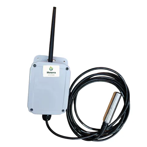
- Groundwater and bore depth: a depth sensor reports a monitoring well’s level on a schedule, so drawdown and recovery show up continuously instead of one dip at a time.
- Soil moisture and weather — soil probes and weather stations round out the site picture for habitat, restoration, and water-budget work.
Built for remote and sensitive sites
The reason monitoring hasn’t reached these places is simple: there’s no power and no internet at a back-country wetland or an outlying well. Meterra needs neither. Sensors run on battery or solar, report over Verizon NB-IoT cellular, install in minutes, and — for level — read the surface from above, so nothing sits in the water to disturb the very site you’re protecting. Where there’s no cell coverage at all, satellite is the alternative; we can check a site before you commit.
Data you can act on, and report
Conservation runs on records as much as readings. Continuous data is what turns a guess into a management decision: the U.S. Geological Survey points to continuous monitoring as the best way to capture groundwater fluctuations during droughts and other critical periods, when real-time numbers drive the call. Meterra keeps every reading, charts the trend, raises alarms on the conditions you set, and exports any sensor’s history to CSV — ready for a grant deliverable, a management plan, a board packet, or a research dataset.
Funding help
Conservation and water-efficiency work is often grant-supported. Many western states fund it directly — in Utah, for example, the state’s water-funding portal and Agricultural Water Optimization Program back water projects — and USDA NRCS programs like EQIP and WaterSMART cost-share on-the-ground conservation. Meterra’s per-point pricing and exportable records make a monitoring line easy to include in an application; eligibility is set by each program, so confirm before you count on it. See our Grants & Funding page for the full list.
Getting started
Start with the site that’s hardest to get to or most important to watch — the wetland you can rarely reach, the well you want a continuous record on, the pond you suspect is losing water. Tell us your locations and the coverage there, and we’ll map the right sensors and a pilot.
The hardware for this job
Every device reports to the same Meterra dashboard and app.
Tell us about your operation and we'll map the right sensors and coverage.
Frequently asked questions
What can conservation groups monitor with Meterra?
The water and land conditions that drive stewardship decisions — pond, wetland, dam, and stream levels; groundwater or bore depth; soil moisture across a site; and weather. Each sensor reports to one dashboard with history and exportable records, so a watershed group, land trust, district, or consultant can watch many sites from one screen.
Can it monitor groundwater or well depth, not just surface water?
Yes. A depth sensor tracks the water level in a monitoring well or bore and reports it on a schedule, so you see drawdown and recovery over time without a manual dip on every visit. The U.S. Geological Survey notes that continuous monitoring is the best way to capture groundwater fluctuations during droughts and other critical periods — which is exactly what remote, automatic reporting provides.
Do remote or sensitive sites need power or internet?
No. Meterra sensors are battery or solar powered and report over Verizon NB-IoT cellular, so there's no mains power, no Wi-Fi, and no hub to install at a wetland, a back-country gauge, or a monitoring well. The sensing is also non-contact for level, so nothing sits in the water to disturb a sensitive site.
Can we export the data for grant reporting and research?
Yes. Every sensor's history is available as a chart and as CSV export over any period, so you can pull the record you need for a grant deliverable, a management plan, a board report, or a dataset. Alarms are logged as well.
Can several staff or partners see the data?
Yes. Multiple-user access lets staff, board members, agency partners, and consultants see the sites relevant to their work from one dashboard, without sharing a single login.
What does it cost?
In our US rollout, sensors start at $299 for the Tank Level Sensor, $399 for the Trough Level Monitor, and $499 for the Dam Level Monitor, each including three months of connectivity and full app access; connectivity is then from $10/month per device, with discounts on annual subscriptions. Costs scale with the number of sites — tell us yours, and we can start with a pilot on one location.
Related Meterra pages
- Pond & Dam Monitoring: remote level on ponds, wetlands, and open water.
- Water Level Monitoring: how remote level sensing works across all water.
- Water Districts: rural and municipal water systems.
- Dam Level Monitor: submerged pressure level for dams and ponds.
- Tank Level Sensor: wireless ultrasonic monitoring for any tank or cistern.