
Keep your fire pond ready, and know the moment it isn't.
A fire pond only does its job if it's holding water when the call comes. Meterra puts a wireless sensor in your fire pond, suppression pond, or dry-hydrant pond and sends the level to your phone, with an alert before it drops below the depth firefighting needs — so a designated source stays a known quantity through the dry months instead of a hope you check on a drive.
A fire pond is only ready if it’s holding water
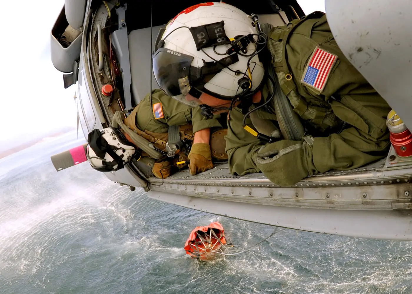
You built or kept the pond for one reason: so there’s water on hand if fire comes. But a pond isn’t a fixed thing. It draws down through a dry summer, loses ground to a slow leak, and creeps toward the bottom in exactly the months wildfire risk is highest. A pond that was plenty in May can be too shallow to draft or dip by August — and the way most people find out is a drive out to look, or worse, the day an engine or a helicopter needs it.
Monitoring closes that gap. A sensor in the pond reports the level continuously and tells you the moment it drops below the depth firefighting needs, so “is the fire pond ready?” is something you know from your phone instead of something you hope. It’s the same idea behind the rest of what we do — know what’s happening, without making the drive.
Why a designated pond still needs proof
There’s a real tailwind here, and it points the same way. As wildfire pressure grows, states and agencies are working to designate and map the water sources firefighters can rely on:
- Colorado statute (§37-82-107, C.R.S.) directs the state to identify, designate, and preserve critical fire-suppression ponds that are readily accessible to fire districts.
- An Oregon NRCS drought-and-wildfire watering strategy asks landowners to allow fire-management access and add the water site to Oregon Department of Forestry fire-management maps, generally for sources with at least 5,000 gallons of storage and vehicle access.
The point all of these share: a mapped source is only useful if it holds water. Designating a pond, registering a dry hydrant, or putting a site on a fire-management map doesn’t keep it full. Continuous level monitoring is how a landowner or a district shows a designated source is actually ready — and gets a record to prove it.
What you get on a fire pond
- Level on your phone. Live depth and percentage, with the trend over the season so you can see how fast the pond is dropping.
- Low-water alarm. Set the depth firefighting needs and get an alert before the pond falls below it — while there’s still time to top up, haul, or plan around it.
- Leak and overflow alerts. A rapid-change alarm flags an unexpected drop; a high-water alarm covers overflow after heavy rain.
- Shared access. Give your fire district, a neighbor, or a manager their own view of the same pond without handing over your login.
- A record you can hand over. Any pond’s history exports to CSV for your files, an insurer, or a fire-district map.
The right sensor for a pond
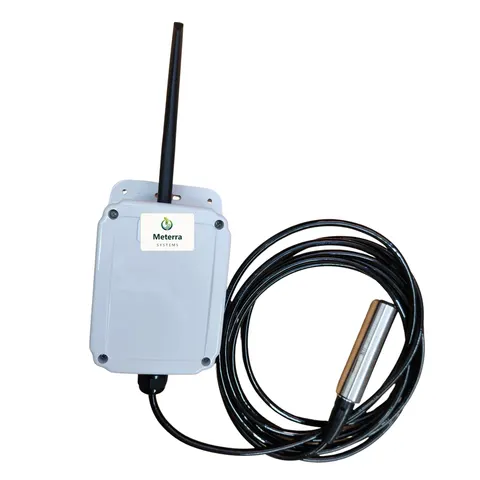
For most fire ponds the default is a submerged pressure (hydrostatic) sensor, the Dam Level Monitor. It sits below the surface, reads the depth above it, and keeps reading under ice, which matters where winters are hard and surface ice would interfere with an above-water sensor. Where you’d rather keep nothing in the water, the non-contact ultrasonic Tank Level Sensor is the alternative. Both report the same level, trend, and alarms; we help you choose by the site.
There’s a second reason a fire pond usually leans submerged, and it’s reach. A pond shallows out from the edges, so the water an engine can actually draft sits in the deep hole, often well out from the bank. An ultrasonic reads from a post or structure above the spot it’s watching, which means building something out over that water. The submerged sensor just goes in on a cable: it sits at the draft point, and the cable runs back to the shoreline where the communication box stays on dry ground. So we size the cable to the whole path, not the depth, and a pond only a few feet deep can still take a long one. We build cable to any length up to about 330 ft (100 m), so the run from the deep hole back to dry ground is rarely what limits where the sensor can go.
More on the trade-off in Pond & Dam Monitoring, and on sizing in cable length is reach, not just depth.
Built for a pond with nothing around it
No power, no Wi-Fi, no hub, no trenching. The sensor runs for 2+ years on a battery, or indefinitely on solar, and reports over Verizon’s NB-IoT low-power cellular network — or LEO satellite for a pond with no cell coverage at all. Coverage is confirmed at your specific pond before you buy.
A note on what this is and isn’t
Meterra supports water-source planning and situational awareness. It does not replace on-scene reconnaissance, the Dipsite Manager, or a pilot’s or fire officer’s own assessment of a water source. It tells you what your pond is holding so you can keep it ready — the call on using it stays with the people on the ground.
Getting started
Start with the pond that matters most — the designated source, the one nearest the buildings, or the one you suspect is leaking. Tell us where it is and the coverage there, and we’ll map the right sensor and a pilot. Designated-source upkeep may qualify for help, too — see Grants & Funding for water-conservation and fire programs. Every sensor is backed by a 60-day money-back guarantee and a one-year warranty.
The hardware for this job
Every device reports to the same Meterra dashboard and app.
Tell us your site and we'll map the right sensors and coverage.
Frequently asked questions
What counts as a fire pond, and why monitor its level?
A fire pond — also called a fire suppression, fire protection, or fire retention pond, often paired with a dry hydrant — is a water source kept available for firefighting, whether drafted by engines or dipped by helicopters. Monitoring matters because the pond is only useful when it's deep enough to draft or dip, and ponds draw down through summer exactly when fire risk peaks. A sensor reports the level continuously and warns you before it drops below usable depth, so the source is proven ready instead of assumed.
Why does this matter for designated or mapped fire-suppression water?
Because a mapped source is only useful if it holds water. Some states are formalizing this — for example, Colorado statute (section 37-82-107, C.R.S.) directs the state to identify, designate, and preserve critical fire-suppression ponds that are readily accessible to fire districts, and an Oregon NRCS drought-and-wildfire watering strategy asks landowners to allow fire-management access and add the water site to Oregon Department of Forestry fire-management maps. Designating a pond doesn't keep it full; continuous level monitoring is how you show a designated source is actually ready.
Does the sensor go in the water, and will it survive a freeze?
For a pond, the default is a submerged pressure (hydrostatic) sensor that sits below the surface and reads the depth of water above it. Because it reads from underneath, it keeps working under ice — a real advantage in cold country, where surface ice can interfere with an above-water reading. If you'd rather keep nothing in the water, a non-contact ultrasonic sensor is the alternative for the right site.
Will it work at a remote pond with no power or Wi-Fi?
Yes. The sensor is battery or solar powered and installs in minutes with basic tools — no trenching, no electrician, no Wi-Fi or hub. It reports over Verizon's NB-IoT low-power cellular network, used for most sites; for a pond with no cellular coverage at all, low-earth-orbit (LEO) satellite is the alternative. We confirm coverage at your specific pond before you buy — we don't claim it everywhere.
What alerts can I set?
A low-water alarm before the pond drops below firefighting depth is the main one, but you can also set a high-water alarm for overflow and a rapid-change alert that flags an unexpected drop, like a leak. Alerts reach you by app and supported channels, and you can give a fire district or neighbor access to the same readings without sharing your login.
How much does it cost, and can I try it?
Our US rollout price for the Dam Level Monitor — the default for a fire pond — starts at $499, including three months of connectivity and full app access; connectivity is then from $10/month per device, with discounts on annual subscriptions. Send your pond details or call and we'll size the setup. Every sensor is backed by a 60-day money-back guarantee and a one-year warranty.
Related Meterra solutions
- Wildfire Water-Source Monitoring: the full picture of ponds, dams, reservoirs, and dip tanks for fire readiness.
- Fire Districts & Wildfire Agencies: monitoring designated sources across many properties, in one dashboard.
- Dam Level Monitor: the submerged pressure sensor for ponds, which keeps reading under ice.
- Tank Level Sensor: the non-contact ultrasonic option for tanks and cisterns.
- Pond & Dam Monitoring: how remote level sensing works on open water, low and high alarms.
- Fire-Season Water Readiness Checklist: what to check on ponds, tanks, and hydrants before the season starts.
- NFPA 1142 Rural Fire Water Supply: what the standard asks of rural water sources.