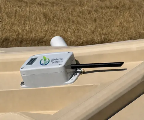
The rain that triggers an inspection: logged, not missed.
Stormwater compliance turns on numbers most sites don't actually capture — how much rain fell and when, and where the pond level sat. Meterra logs rainfall at the site and the level in a sediment basin or detention pond, time-stamped and exportable, so a construction SWPPP or an MS4 program has the record its inspections and reports run on — without someone standing at a gauge in the storm.
Compliance hinges on a number you usually don’t have
Stormwater rules are documentation rules. The question on a construction site isn’t only “did you inspect” — it’s “did you inspect after the rain that required it,” and that depends on knowing how much fell and when. On the municipal side, an MS4 program has to show its detention and retention ponds are doing their job. Both run on records, and both usually rely on someone reading a gauge or a nearby airport’s rainfall after the fact.
Meterra captures the record automatically. A logging rain gauge time-stamps rainfall as it happens; a level sensor time-stamps what the basin or pond did in response. The result is a clean, exportable history — and an alert the moment a threshold is crossed — so compliance rests on data, not memory.
What Meterra watches
- Rainfall — a logging weather station / rain gauge records totals and season-to-date, and can alert when a storm passes your permit’s threshold.
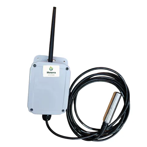
- Sediment basins — level and trend through a storm, with alerts on a high level or a basin that isn’t drawing down.
- Detention and retention ponds — confirm post-construction controls perform, with exportable history for MS4 reporting.
Everything reports to one dashboard with CSV export and multi-user access for the contractor, inspector, and engineer.
Built for a raw site
No power, no Wi-Fi, no hub. Sensors run on battery or solar, install in minutes, and report over Verizon’s NB-IoT low-power cellular network, with LEO satellite where there’s no coverage — confirmed per site before install.
A note on what this is and isn’t
Meterra supports stormwater monitoring and recordkeeping. It does not replace the inspections, qualified personnel, sampling, or permits your NPDES or MS4 obligations require, and it doesn’t certify compliance. It gives you the timestamped rainfall and level data those obligations are documented with — confirm your specific requirements with your permit and your authority having jurisdiction.
Getting started
Start with the site or basin under the most scrutiny. Tell us the location and the coverage, and we’ll set the rain gauge, the level sensor, and the alert thresholds to your permit.
The hardware for this job
Every device reports to the same Meterra dashboard and app.
Tell us about your operation and we'll map the right sensors and coverage.
Frequently asked questions
How does this help with construction stormwater (SWPPP) compliance?
Construction sites under an NPDES Construction General Permit generally have to inspect after a qualifying rain event — commonly a storm over 0.25 inch, though the exact threshold is set by your permit. A logging rain gauge records rainfall as it happens and can alert you the moment the threshold is reached, so the inspection clock starts on a documented number instead of a guess. It supports your SWPPP recordkeeping; it does not replace the inspections, qualified personnel, or the permit itself.
What about municipal (MS4) stormwater?
MS4 programs manage post-construction controls like detention and retention ponds. A level sensor reports how those ponds behave through and after a storm, with history you can export for reporting, and alerts on a high level or a slow-draining basin. It's a monitoring and documentation aid, not a substitute for your permit obligations or engineering review.
What exactly does Meterra log?
Rainfall and season-to-date totals from an on-site weather station, and water level in a sediment basin, detention pond, or retention pond from a level sensor — both time-stamped to one dashboard, with CSV export over any period and configurable alerts. Multi-user access lets the contractor, the inspector, and the engineer see the same record.
Will it work on a raw site with no power or internet?
Yes — that's the point. Sensors are battery or solar powered and report over Verizon's NB-IoT low-power cellular network, with LEO satellite where there's no coverage. No mains power, no Wi-Fi, no hub on a muddy site — coverage confirmed first.
What does it cost?
In our US rollout, sensors start at $299 for the Tank Level Sensor and $499 for the Dam Level Monitor, each including three months of connectivity and full app access; connectivity is then from $10/month per device, with discounts on annual subscriptions. Tell us your sites and we'll size it. Every sensor is backed by a 60-day money-back guarantee and a one-year warranty.
Related Meterra pages
- Remote Weather Monitoring: the logging rain gauge and weather station.
- Flood & Low-Water-Crossing Monitoring: rising-water alerts for crossings, culverts, and basins.
- Pond & Dam Monitoring: open-water level sensing for basins and ponds.
- Dam Level Monitor: the submerged pressure sensor for basins and detention ponds.
- Water Level Monitoring: the basics of remote level sensing.